The 2023.1 Orion release of GVERSE GeoGraphix launches a new era for the evolution of XSection. All of the features users know and love about XSection carry forward in a new environment, GVERSE Geo+, that enables the integration of geology, geophysics, petrophysics, mapping, GIS, and geosurface modeling in one application. GVERSE XSection can be launched from either GeoAtlas, as XSection is launched now, or from the Map View of GVERSE Geo+. Once launched, GVERSE XSection works exactly as you would expect XSection to work with common menus, toolbars, and performance in the un-modeled state thus creating a flat learning curve.
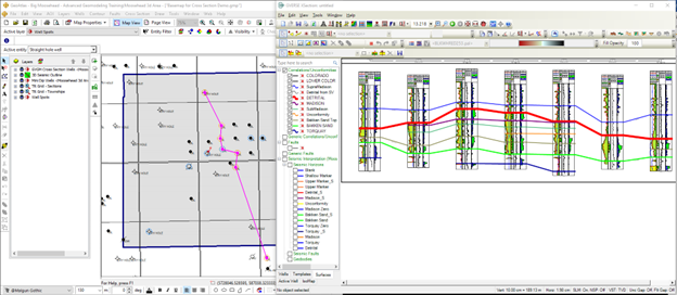
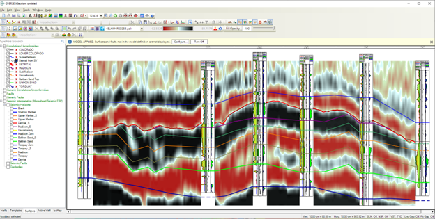
In addition to all the familiar XSection features, GVERSE XSection brings so much more to the table. The user interface presents a new data panel in the cross-section window that allows users access to the Wells, Templates, Surfaces, Presentation Templates, and IsoMap layers without having to open menus. The Type Log tool not only allows stretching and squeezing of the log but also allows stretching and squeezing of formation surfaces within the type log. In addition to formation tops, depth converted geophysical horizons are directly accessible from the data panel. A depth converted seismic background is also available if there is a GVERSE Geophysics interpretation. Don’t worry that the XSection cross sections will have to be reproduced in GVERSE XSection. Simply bring the existing XSection cross sections and XSection templates over in bulk to the GVERSE Geo+ environment or import XSection cross sections from an XSection layer on the map.
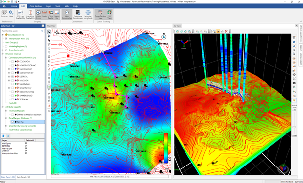
With a simple click of a button, the cross section can be converted from a 2D to a 3D object. Well picks are automatically converted to live 3D geosurfaces on the cross section. Cross sections are displayed as fence diagrams in the 3D View. Map surfaces are automatically generated and if configured, so are subcrop maps, thickness maps, and property attributes from ZoneManager data.
With geosurface modeling turned on, Block Diagrams, smartSTRAT geosteering, and micro-seismic are available. Buffered projected cross sections allow the user to create one cross section and use it anywhere in the project/AOI by simply dragging the line-of-section to a new location on the map.
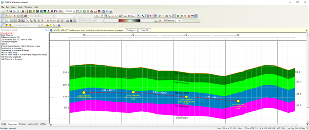
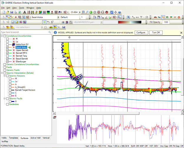
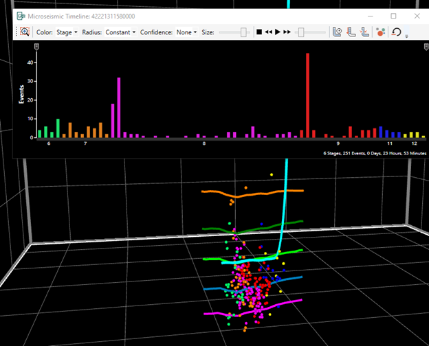
GVERSE Geo+/GVERSE XSection brings the best of two worlds. GVERSE XSection in the un-modeled state works exactly like XSection does so the user can begin to work with it immediately with little or no learning curve. As the user becomes more advanced, they can turn on the optional geosurfaces modeling feature to take the interpretation to the next level with automatic surface modeling, conformance technology, subcrop mapping, isochore and isopach creation, fault offset and polygon generation, and ZoneManager property mapping. Whatever the user wants, from a simple cross section creation for correlation purposes to full geosurface modeling, GVERSE Geo+/GVERSE XSection has the right tools for everyone.


